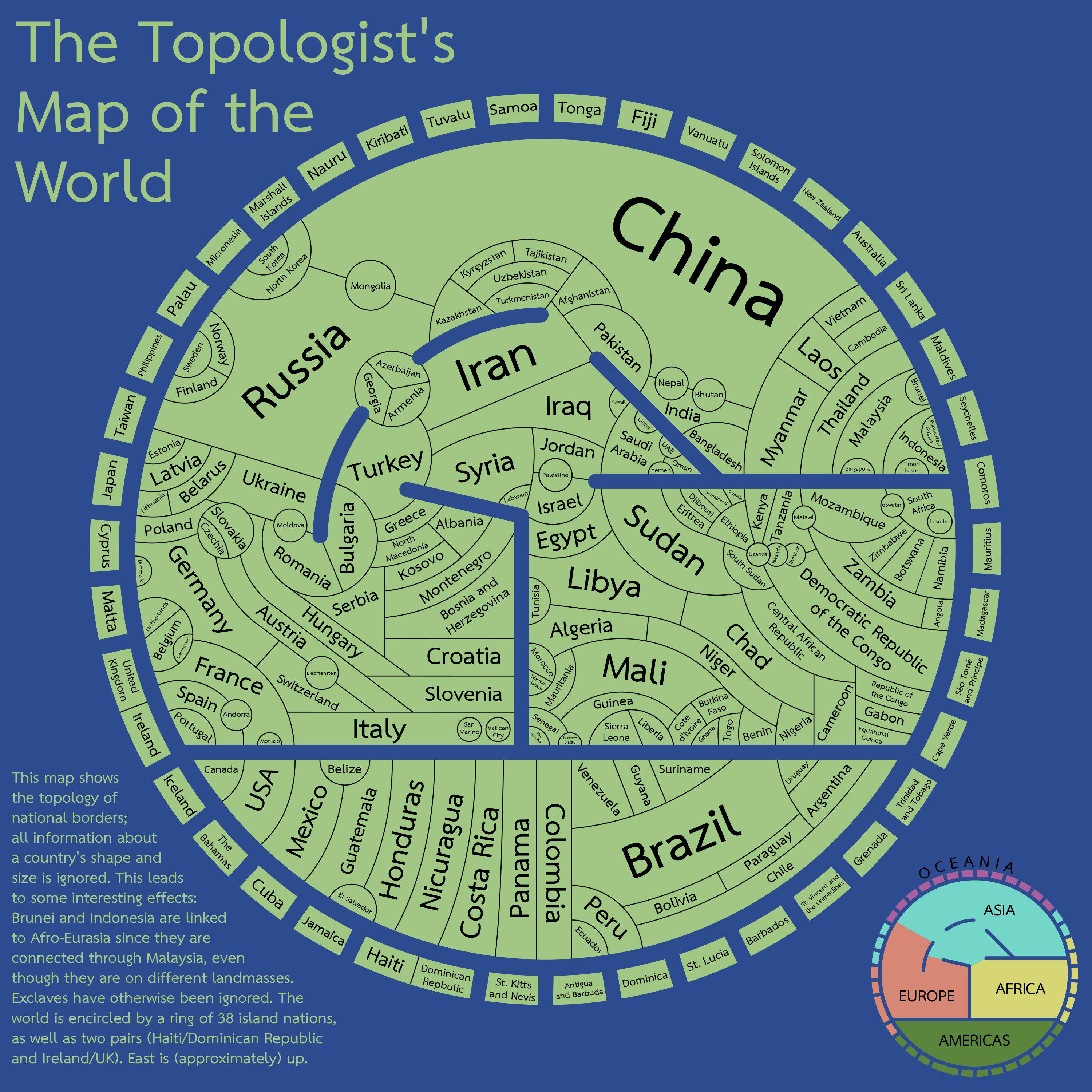
It made me think about that “maps only need 4 colors” (I don’t remember the proper name, but it’s an idea that maps with political borders can paint every state/country/whatever using 4 different colors and you’ll never get the same color bordering another), seems like the perfect opportunity to see if it applies here
And well, it’s actually mathematically proven, but not for maps with disjointed regions that need to be colored the same, such as Alaska + mainland USA.
(In that particular case, it’s not too difficult to resolve, but you don’t get a guarantee for it.)
The map in the post actually merges such disjointed regions, though, so it absolutely should work there.
East Africa and the Balkans took a little bit of figuring out
Edit: and sure enough, there’s actually a mistake in East Africa. DR Congo and Tanzania shouldn’t be the same colour. I think it can be fixed with the following changes:


It made me think about that “maps only need 4 colors” (I don’t remember the proper name, but it’s an idea that maps with political borders can paint every state/country/whatever using 4 different colors and you’ll never get the same color bordering another), seems like the perfect opportunity to see if it applies here
It’s the Four Color Theorem.
And well, it’s actually mathematically proven, but not for maps with disjointed regions that need to be colored the same, such as Alaska + mainland USA.
(In that particular case, it’s not too difficult to resolve, but you don’t get a guarantee for it.)
The map in the post actually merges such disjointed regions, though, so it absolutely should work there.
Here’s a way to do it https://i.imgur.com/YULx0sg.jpeg
East Africa and the Balkans took a little bit of figuring out
Edit: and sure enough, there’s actually a mistake in East Africa. DR Congo and Tanzania shouldn’t be the same colour. I think it can be fixed with the following changes: