They should just secede from the union and be a small city state.
Would it benefit anyone? No. Would it be very costly to make the transition and potentially wreak havoc on the community? Absolutely. But would it create a sense of civic pride and feel good for the residents of Point Roberts? Also no.
It’s also too late now, even if you come to a political agreement you’d have to buy them out, have to hear about unseating American families, and I doubt Canada is willing to do that. What’s the point for that insignificant land?
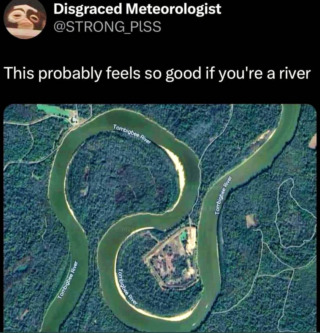
Because they change and move over time. This river definitely didn’t start out like this and it almost certainly will look very different in just a few years’ time.
Just recently my country exchanged land with a neighbouring country to adjust for the changes of water, each giving and gaining the same amount of land. When water marks the border it’s much easier to know when you’re crossing it.
Edit: looked it up: in march we (Austria) traded 239 m² with Liechtenstein
The alternative is pretty fucking stupid too. Imagine losing access to your freshwater because the river shifted across an imaginary line. At least when the border is the river, you always have access to the river.


This is why setting borders based on rivers is fundamentally flawed.
This message brought to you by the latitude/longitude gang.
I mean, you say that now, but if someone stood on the other side of the river and shot arrows at you, would you really disagree with them?
Point Roberts has entered the chat
Such a stupid border decision. They should have fixed it in the territory swaps a few years ago.
They should just secede from the union and be a small city state.
Would it benefit anyone? No. Would it be very costly to make the transition and potentially wreak havoc on the community? Absolutely. But would it create a sense of civic pride and feel good for the residents of Point Roberts? Also no.
What territory swaps a few years ago?
It’s also too late now, even if you come to a political agreement you’d have to buy them out, have to hear about unseating American families, and I doubt Canada is willing to do that. What’s the point for that insignificant land?
A while ago (late 90s?) they straightened the border and reevaluated land along the 49th parallel. Some towns switched countries.
Northwest angle
It’s all arbitrary anyway…
Why? Apart from such cases being rare, everyone gets a half island
Because they change and move over time. This river definitely didn’t start out like this and it almost certainly will look very different in just a few years’ time.
Just recently my country exchanged land with a neighbouring country to adjust for the changes of water, each giving and gaining the same amount of land. When water marks the border it’s much easier to know when you’re crossing it.
Edit: looked it up: in march we (Austria) traded 239 m² with Liechtenstein
Good point, that’s a cool solution too!
I know they’re rich, but they’re so small, you should have just let them keep it.
The alternative is pretty fucking stupid too. Imagine losing access to your freshwater because the river shifted across an imaginary line. At least when the border is the river, you always have access to the river.