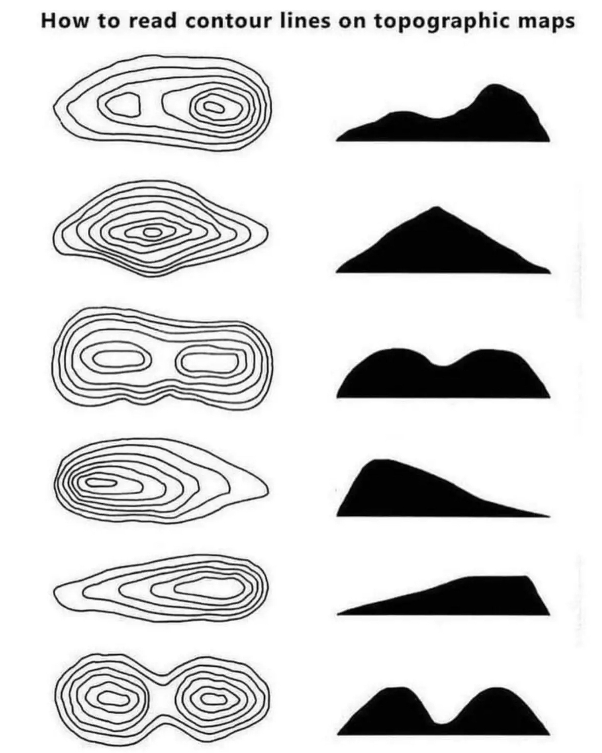
I always found these very intuitive, but I don’t know if that’s just due to having an analytical mind, or just learning this stuff early. Do people struggle to understand topographic maps?
It gives a basic idea, but I think something like Cities:Skylines where you can create maps using a height map and then get the topography lines in a 3d space where you can actively shift the camera around to see them overlaid from any angle would probably help people grasp the idea.
Having said that, I’m now imagining drone footage overlaid with the height maps as an additional resource to standard topographical maps. Would be neat if somebody could create software that could calculate and overlay the height maps in real-time using the drone’s altimeter or something.
In the Land Nav portion of PLDC (US Army training for becoming a Sergeant - is called something else now) there were soooooo many people that failed out/had to do it over again, that I was super worried when I did it. Seemed pretty damn easy to me. 🤷

I always found these very intuitive, but I don’t know if that’s just due to having an analytical mind, or just learning this stuff early. Do people struggle to understand topographic maps?
I think your analytical mind got “typographic” and “topographic” mixed up…
Ah, was it a typo or topo that got autocorrected? We’ll never know (fixed, ta).
deleted by creator
It gives a basic idea, but I think something like Cities:Skylines where you can create maps using a height map and then get the topography lines in a 3d space where you can actively shift the camera around to see them overlaid from any angle would probably help people grasp the idea.
Having said that, I’m now imagining drone footage overlaid with the height maps as an additional resource to standard topographical maps. Would be neat if somebody could create software that could calculate and overlay the height maps in real-time using the drone’s altimeter or something.
In the Land Nav portion of PLDC (US Army training for becoming a Sergeant - is called something else now) there were soooooo many people that failed out/had to do it over again, that I was super worried when I did it. Seemed pretty damn easy to me. 🤷